
Drone Roof Inspection in Killeen, TX
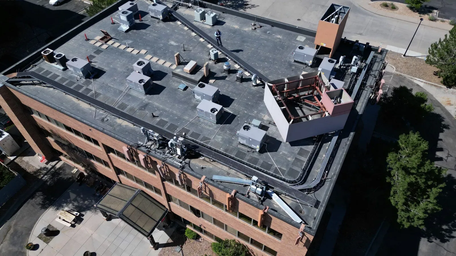
A large roof or difficult access route can make a first look hard to organize. Drone imaging gives the owner a broad visual record of roof sections, edge lines, rooftop equipment, and visible drainage patterns. We plan the flight around site conditions, then label useful images on a roof map. The imagery helps prioritize a closer look; it does not confirm hidden moisture, adhesion, deck condition, or a seam’s bond. Those questions still need a hands-on check or a selected test.
What Can the Images Show?
From above, the camera can document surface wear, debris, ponding patterns, displaced metal, rooftop obstructions, and areas that are difficult to view from a hatch or ladder. We use repeatable image angles where practical and identify the roof section in each set. That record can help an asset manager compare an area over time, direct a repair crew to a detail, or decide where an inspection needs more access. It is a visual reference, not a measurement of the condition below the membrane.
For a Killeen flight assignment, we confirm the roof outline, launch point, customer and loading movements, and site permission with the property contact. US 190 and local arterials help orient a Killeen assignment, but a roadway cannot establish a private property boundary or grant flight permission. At a building near Clear Creek Road and SH 201, we verify the launch area and roof boundaries with the site contact. A hands-on inspection follows where the image cannot answer a material or fastening question.
Where Does an Image Need a Field Check?
Glare, shadows, rooftop units, parapets, tree cover, and image scale can hide or distort a detail. A dark patch does not establish wet insulation, and a smooth surface does not prove that a seam is bonded. Drone images can miss a small puncture or a crack under a curb. We flag areas that need ladder access, a roof walk, thermal review, or a core rather than assigning a diagnosis from appearance alone.
We connect each flag to a next step: photograph at closer range, inspect the detail in person, compare it with repair records, or sample the assembly. Where moisture mapping would help select test cuts, an infrared and core survey can combine surface patterns with physical confirmation. If an active opening is visible, an on-roof leak investigation determines whether the image corresponds to the entry point. This separation keeps a visual observation from becoming an unsupported repair quantity.
How Is a Flight Coordinated?
Before capture, we confirm roof access, operating areas, people movement, equipment, flight boundaries, and the building contact who can authorize the visit. We do not assume that an open parking area or roof hatch is available. Weather, wind, visibility, and safe launch space can change the flight plan. If conditions prevent useful images, we reschedule or use a ground-based method rather than deliver a record with gaps presented as coverage.
Killeen’s occupancy certificates from April 2025 through March 2026 included expanding restaurants, retail, childcare and education, medical offices, and fitness uses. The count does not tell us whether any individual roof is occupied during imaging. We confirm schedules and protect customer, employee, and delivery paths with the site contact. The same coordination applies to launch areas and roof access across the city. A building operations plan can connect the image visit to later hands-on work.
How Does the Image Set Support a Roof Decision?
We sort images by roof section and connect them to the owner’s question. If the issue is drainage, the image set can mark low areas, outlets, and visible ponding for a field check. If an edge has moved, the closer inspection can check metal attachment and the membrane termination. If a portfolio needs triage, we can identify which roofs need immediate access and which can be revisited in the next budget window. The recommendation remains tied to what the image and field work actually show.
Highs reach 100°F or more on an average of 18.3 days each year in Killeen, a reason to plan flight and roof-walk timing around actual conditions. That frequency makes capture time and roof-surface heat worth recording when imagery is compared, but it cannot establish a membrane defect. We use the image to locate visible aging, then check the material and adhesion directly. A condition report can hold the image map with close photographs and sample results, while capital planning can distinguish repair-now sections from later replacement work. The record should make the next inspection more targeted, not imply that every surface issue requires a project.
Following hail or wind reports, image comparison may help locate new debris, displaced metal, or visible surface marks. During a 2003 Killeen event, hail reached 1.75 inches while a tornado was rated F0; imagery still needs a property baseline for comparison. The historical entry can help define a post-event image comparison, while any present damage still must be verified at the property. We compare the property’s own baseline with new imagery and verify suspected damage from the roof. A close roof walk can define that follow-up.
What Belongs in the Image Record?
The deliverable should identify the property and roof sections, capture date, image orientation, areas not visible, and recommended field checks. We note whether rooftop equipment, parapets, or shadows blocked a view. The image labels should match the roof map and avoid guessing at a membrane type from color alone. If images are retained with later repair records, the next reviewer can compare the same area and see whether a visible condition changed.
For roofs around Downtown Killeen or the Rancier Avenue corridor, the image set is organized by actual roof boundary rather than neighborhood label alone. We keep any observation from a neighboring property out of the client’s condition record. When a drone view identifies a priority, we schedule the appropriate roof walk, moisture test, or repair. Request imaging when broad visual coverage will help narrow the next decision, and pair it with field confirmation for anything concealed or safety-critical. The file should preserve original images at usable resolution, with an index that lets another reviewer locate each labeled roof section without a verbal handoff. If the images follow a hail or wind report, retain the capture date and compare each marked area with the property’s prior photos before assigning any repair scope.
Commercial Roofing Questions
Can a drone inspection replace a hands-on roof inspection?
No. Images can document broad visible conditions and help direct access, but they do not confirm a seam bond, concealed moisture, deck condition, or material attachment. We specify the field check needed for each unresolved question.
Can drone images show wet insulation?
A standard image shows surface appearance, not moisture below the roof membrane. Thermal imaging may help locate patterns for testing, but a core or cut confirms the assembly condition. The report keeps each observation and test result distinct.
What happens if wind prevents the flight?
Safe operating conditions control the capture. If wind, weather, or visibility prevents useful imagery, we reschedule or select another inspection method. The final record lists areas not captured rather than implying complete coverage.
How do you use images after a storm?
We compare the roof with a prior image set when one exists, mark visible changes, and confirm suspected damage from the roof. A storm report alone does not establish damage to an individual property, and imagery does not replace physical inspection of a questionable detail.
Will the images identify the roof system?
Color or pattern alone may not establish a membrane or coating type. We compare images with service records and inspect a representative detail where identification affects repair materials. Any uncertain system identification stays marked for confirmation.
Use Imaging to Set the Next Inspection
Tell us which buildings, roof areas, or conditions need a visual record and what decision the images should support. We will coordinate access, document capture limits, and identify where a hands-on check or moisture test is still needed.